The evolution of paths
Audio guide in English
THE DRAMONT DISTRICT, UNINHABITED BEFORE THE QUARRY EXPLOITATION, WAS CROSSED BY THE CUSTOMS ROAD.
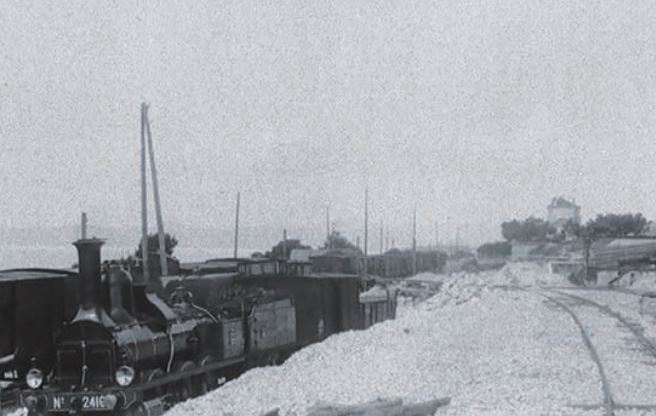
IN 1863, THE SOCIÉTÉ DU PARIS-LYON-MÉDITERRANÉE OPENED THE RAILWAY AND CREATED A LEVEL CROSSING ALLOWING THE CONTINUITY OF THE CUSTOMS ROAD NORTH OF THE RAILWAY
(CURRENT ACCESS TO THE CAMPSITE). TO THE SOUTH, THE EXPLOITATION OF THE PLOTS IN 1863 PREVENTED TRAVEL BY THE SEASIDE.
From the level crossing, the route of the original road runs along the
railroad tracks east then heads north, nearby
of what will become the East quarry (the lake), then descends
in the direction of the tunnel under the railway, (after the School
current), to reach the seaside.
From 1883, the development and extension of
exploitations make the path unusable: the extraction
porphyry is now done north of the lane of
railway, mainly the East quarry. The path
is moved and runs along the railway line to the north. This is what
current path "of the boars"
In 1899, the company ceded to the municipality a band
of land, located south of the railway line, in order to create
the deviation of the local road n° 7. In 1903, the road
of the Corniche linking Saint-Raphaël to Cannes
will be carried out by Le Touring Club de France at this location.
In order to avoid the isolation of the village, the municipality signs
an agreement in 1899 with the Société des Carrières,
for the construction of a bridge over the railway line.
Built in 1902, this access to the village, still in use, will be
enlarged in 1970.